After leaving Capitol Reef, another 3-hour drive got me to Bryce Canyon City, just outside of Bryce Canyon National Park. Bryce Canyon City is the proverbial one-horse town. The major hotel, campground, RV park, gas station and restaurant is owned by one family. There is nothing wrong with this, I think that they did a decent job of civilizing the wilderness.
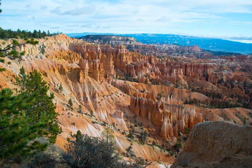
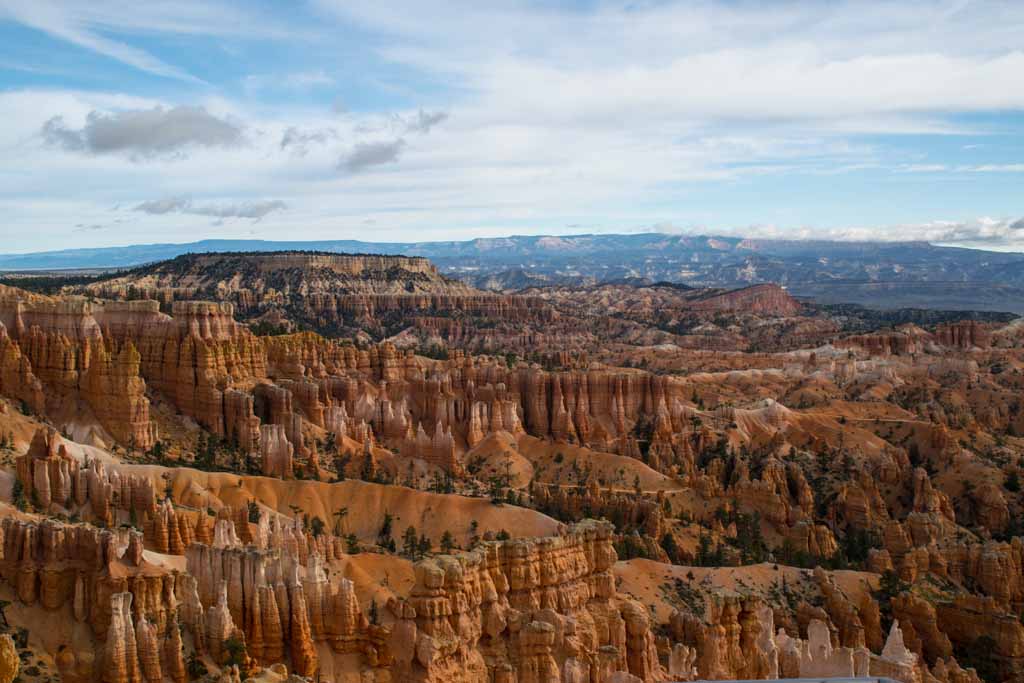
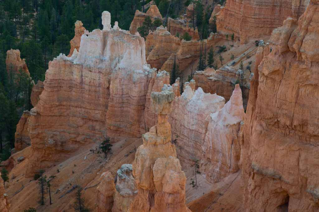
Bryce Canyon is known for its "hoodoos". According to Wikipedia, a hoodoo is "a tall, thin spire of rock that protrudes from the bottom of an arid drainage basin or badland. Hoodoos, which may range from 1.5 to 45 meters (4.9 to 147.6 ft), typically consist of relatively soft rock topped by harder, less easily eroded stone that protects each column from the elements. They generally form within sedimentary rock and volcanic rock formations." As you look thru the photos below, you can see that, while they all look the same, each set of formations is different from the others.
At Bryce Canyon I deviated from my usual logical way of visiting and keeping track of what each photo location is. I think I was getting tired of touring, so the names might not be totally accurate, but the beauty is. So, just enjoy the beauty.
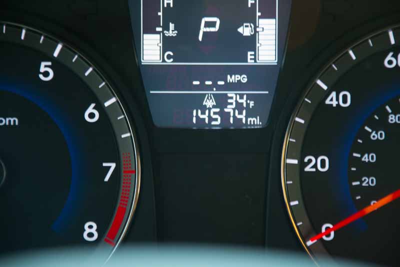
My first morning was a cold. The weather in Moab was in the 60's and 70's. This picture shows the temperature sensor on my rental car. The 34 degree indication was taken about an hour after I got up. It was 25 when I started, and warmed up to the high 40's. BRRRRRR!
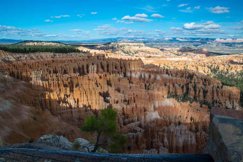
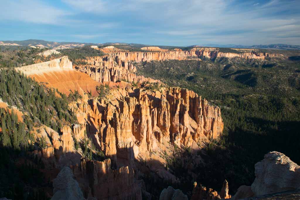
The first afternoon I went to "Inspiration Point". While it was impressive, after a week of natural beauty, I was not easily inspired.
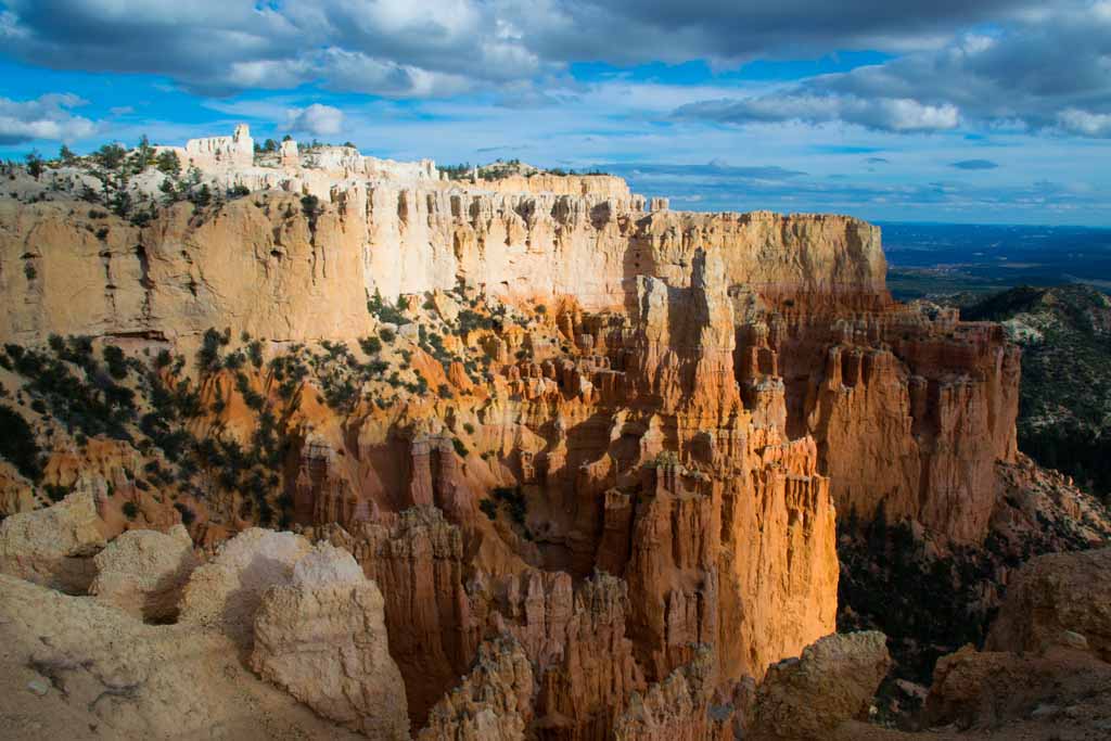
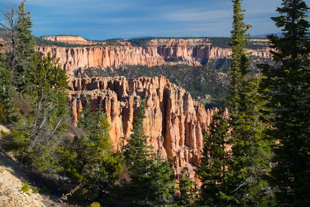
Another afternoon shot near the north end of the Park.
The wall of the canyon provides a nice contrast to the hoodoos below.
Looking down from the plateau, the valleys below are forested and deep.
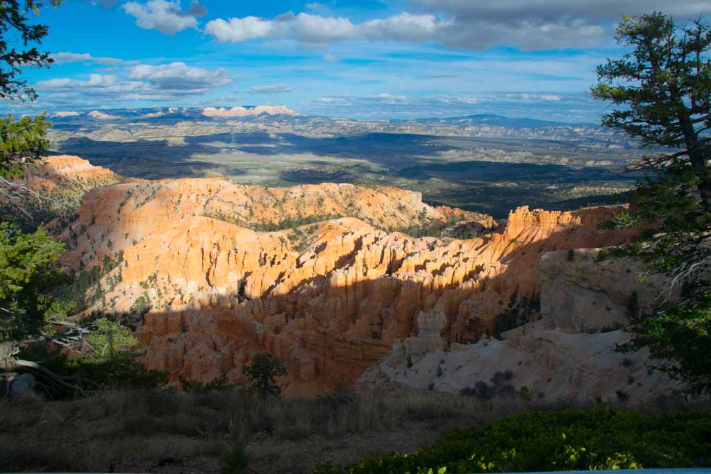
This shows that, on a clear day, you can see for almost 100 miles.
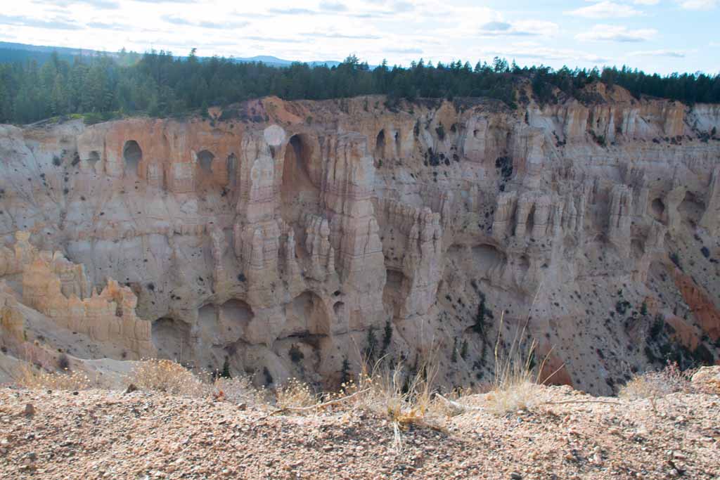
At this area, The upper reaches of the canyon wall is full of caverns and hollows. It looks like the box seats in an opera house/
The roadway in Bryce is 18 miles long, and the recommended route is to drive to "Rainbow Point" and work your way north. So this is Rainbow Point.
This is a shot of "Black Birch Canyon". You can see that the hoodoos are different here than at the previous location
At Black Birch Canyon, the trees grow up an over the rim of the canyon, and view stretches out in the distance.
This is Ponderosa Canyon, named no doubt for the ponderosa pines.
Another look at the formations called "hoodoos"
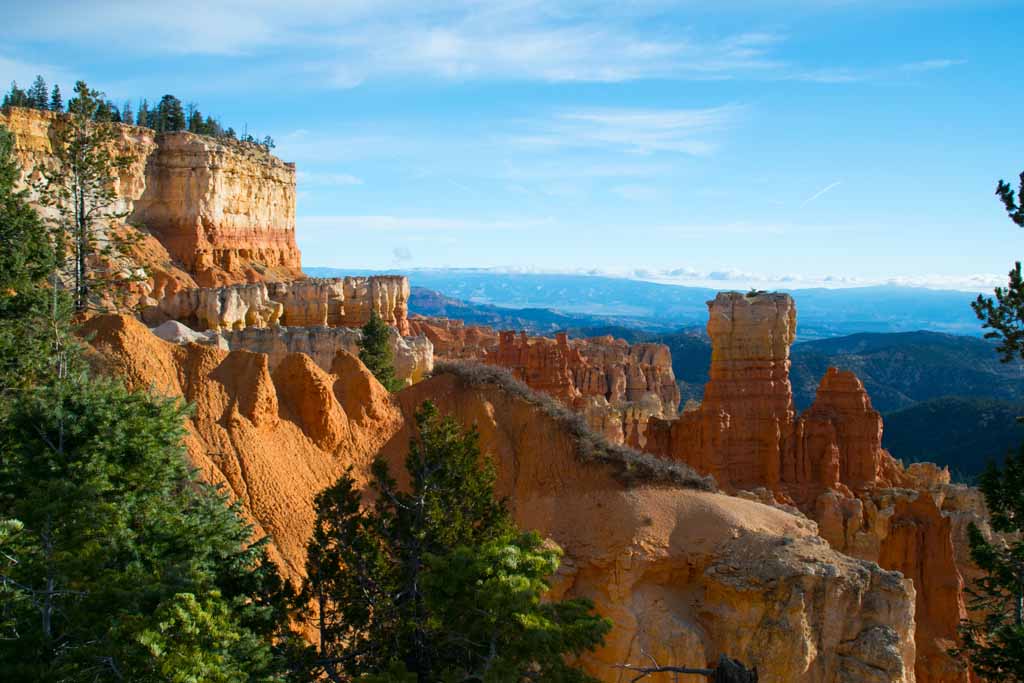
This location is called Agua Canyon.
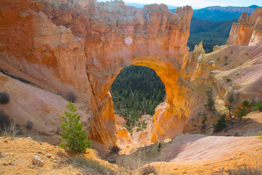
This location is called "Natural Bridge", but technically it is an arch and not a bridge.
This is an area called Swamp Canyon - no idea why.
This is at Far Point - namely the horizon is a far point in the distance.
At Sunrise Point you get a view of the Boat Mesa, and the Sinking Ship Mesa.
Many of the hoodoos in the park have names. The pillar in this photo is called "Thor's Hammer".
Another view of Thor's Hammer. There is a trail one can walk down to get to the bottom of this canyon. Maybe next time.
All things considered, Bryce Canyon is a great place for geology fans to visit, as well as for the rest of us. Beauty is everywhere, and during the summer, so are the tourists. I found that early November was idea as it was not too cold yet, and the tourists were - for the most part - gone. If you ever visit Las Vegas, go to Bryce Canyon, which is a couple hours to the north east.
If you want more information, e-mail the author at: